Lakewood has a Bike Friendly Community Designation. Below is our report card.
Go to Bike Friendly Communities HERE.
There are many places in Lakewood where some small changes (Like painting the street lines better) can improve 2 wheeler safety.
Below are several examples of where gross changes are needed.
The bike lane ends here. BUT east of the park it picks up again. So 2 wheelers detour onto the sidewalk on the other side of Garrison, then go down the narrow path (that you can see on the left side of the picture), then make a right turn and go back over to Florida. Trouble is that path/sidewalk is narrow and there are often walkers, which creates a conflict there. So it really slows you down. The solution is to put in a wide two way bike path from the end of Florida here, straight through the park, connecting back to Florida. Easy Peasy
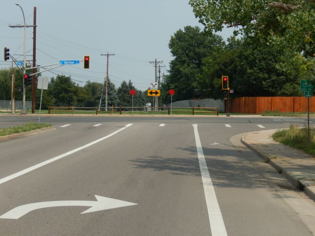
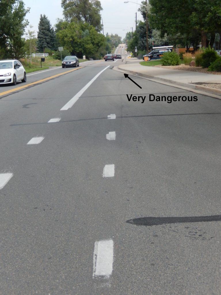
Garrison at Alameda Bicycle Squeeze
Garrison is a major North-South route for 2 wheelers. It’s a wide road with a bike lane often, and it crosses under 6th Ave.. Yet at Alameda the bike lane disappears. Follow the line of sight from the bike lane in the foreground to the other side of the intersection. Where exactly are 2 wheelers supposed to go???
If I don’t feel safe getting in front or behind the cars moving north, I take the sidewalk on the right, but there’s a major problem there too. Visibility is limited to see where the traffic is when getting back on the road. It’s a lose/lose situation.
See the green area that swings around in front of the police car. No one knows what it’s for. But Lakewood knows just how dangerous this intersection is, so they painted this green area for bikes to pull in front and wait for a green light – in front of the cars. That way the bikes get to lead the cars through the squeeze. This goes over well with drivers, especially because the bike lane doesn’t pick up again until after that little rise in the distance.
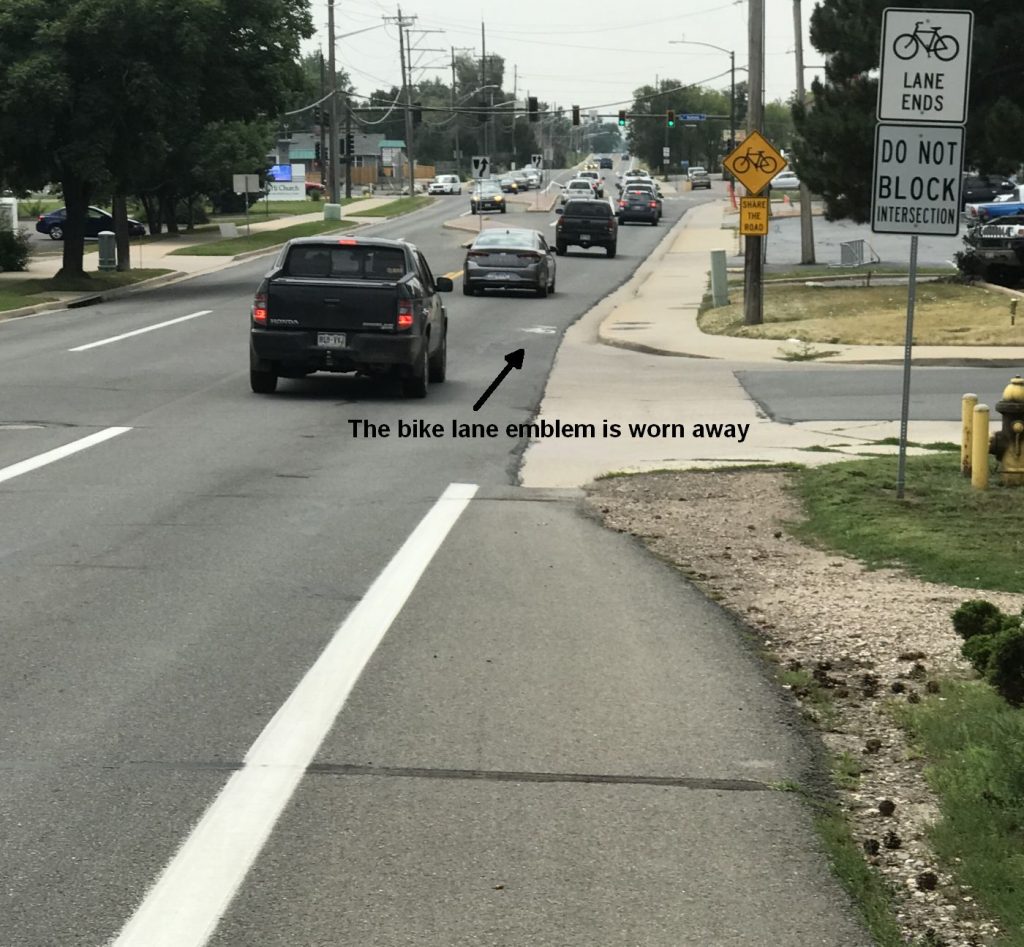
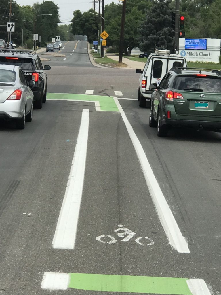
Nice that there’s a sign there stating that that the bike lane ends. I’m usually too busy watching my mirror so that I can gauge when it’s safe to pull into the center of the lane and take over the entire lane. There’s obviously not enough room ahead for cars AND bikes at the same time. I’ve never taken the sidewalk going in this direction. Notice the lip you’d have to jump if you just rode straight, or the short distance you have to maneuver to NOT run into the pole with the ‘Share the road’ sign. It’s safer to use my mirrors and take the full lane, when it’s safe.
The real solution is to take out these center islands so the road is wide enough for both cars and bikes. Probably even taking out the two turn lanes in this photo, or widening the road to the sidewalks.
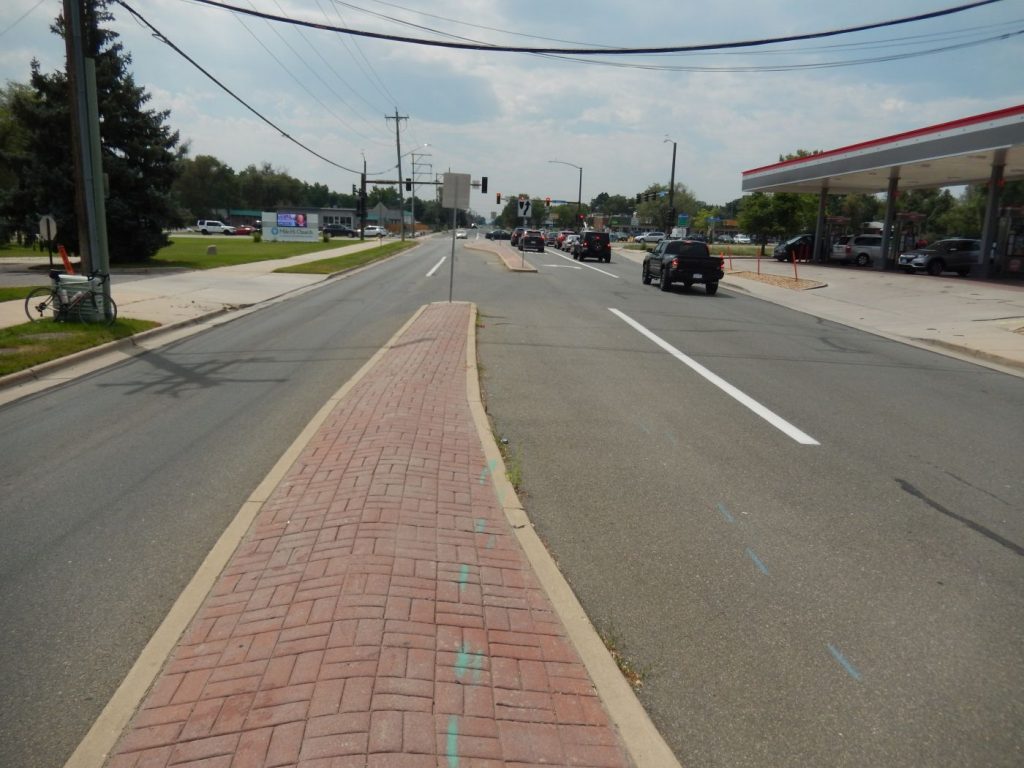
Notice the curb swinging out and pushing into the bike lane. We should trim that sidewalk back a little – especially because the area where the concrete meets the pavement throws bikes around. At the very least we could paint that curb bright red, so 2 wheelers unfamiliar with this obstacle won’t suddenly find themselves in the car lane.
20th Street
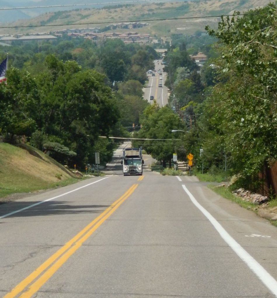
Here there is a bike lane painted onto the street. Trouble is it’s on the wrong side of the road. Bikers move slower going uphill, than downhill. If it’s steep enough we can catch cars (It’s not here, but we’ll be going about 3 times as fast downhill as uphill.) Coming downhill it’s safer to use a mirror and take over the entire lane, than it is to ride to the right where vehicles and pedestrians can pop out of side streets. Going uphill we can use a bike lane to grind it out. (If you see that pavement to the right of the street and think bikes should use that, see the next picture.)
The broken up pavement ends, and a bike lane picks up on the street.
This shows why I will not ride on sidewalks, unless it’s absolutely necessary.
Bikes will go through this intersection, moving from the ‘sidewalk’ to the bike path quickly. Drivers coming east, who want to turn north, are watching for other cars going west, not bikes. Drivers going west, who want to turn north, are not watching for bikes (Or they are trying to beat them to the corner – happens a lot) Plus drivers going west are in the bikers blind spot, even with a mirror. Finally drivers coming out of Iris street are used to pulling up close to 20th street because the trees on the west block the view of anyone on 20th. Exactly into the path of the bikes.
It looks like an innocent intersection, but it’s dangerous in too many ways. Better to ride in the road, and slow auto traffic. Sorry about that.
20th is a major East-West bike route, but the street in this area needs to be widened with bike lanes put in.
20th Street Bicycle Death trap
Notice the bike lane going down the hill, and there’s a bike lane in the distance.
I could explain what’s wrong here, but it’s pretty obvious. Where are the bikes supposed to go when the bike lane suddenly stops? Consider that the hill up to this point is steep, bikes can be traveling faster than cars. They should take down that ‘Share the road’ sign, and put up one that reads “Up yours 2 wheelers” That would be more accurate.
Where are the bikes supposed to go again? That ratty little sidewalk? Pedestrians will love that, especially when we are trying to maintain a full head of steam to climb the nasty hill ahead.
National Renewable Energy Lab (NREL)
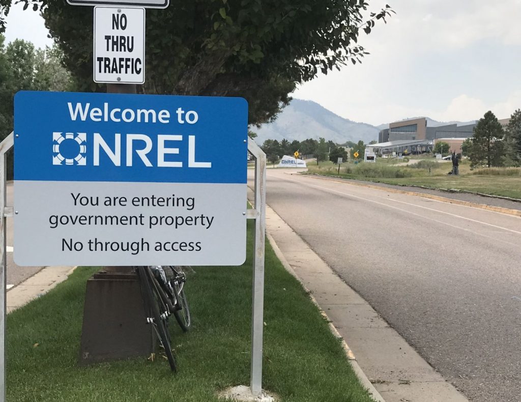
That’s right you can’t ride a bike through the nations RENEWABLE energy lab grounds. Is this ironic, or just the stupidest thing you’ve ever seen?
Notice the nice wide bike lane that runs up the street here. This street runs through Denver West Office park. The street used to be two lanes (no room for bike lanes), but they took one lane out and made it into a bike lane. Now there’s a very nice bike lane that goes nowhere.
Road Milling
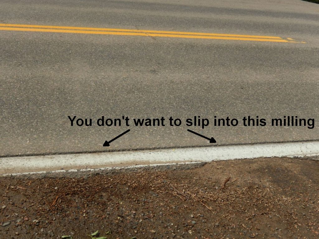
Sigh…… A few years back they decided to mill the roads before painting center and border lines. I don’t know why, maybe so the paint sticks better?
Trouble is they can’t seem to keep the milling to a light touch. Here’s an example on Highway 74 (Bear Creek Road) in Idledale. It’s a real problem for bike safety when the line separates the road from the shoulder. I like to ride the shoulder, when possible, but crossing over the milling can be dangerous because it can catch your wheel and throw you. I’d just as soon ride in the road. Or I’ll treat the milling like a railroad track and cross at a high angle. Drivers love that. I’m either in their lane (and I don’t have to be), or I’m making sudden maneuvers in front of them. (Actually I don’t do that because I use my mirror extensively, and ride defensively. Not everyone does.)
Road milling is just a bad idea.
Sept 12 2021 Milling Update.
Jeffco has milled and painted new white border lines on the road between Morrison and Evergreen. The milling is deeper than it used to be, and is now a serious hazard to bicyclists. I rode down that road the other day, and I had to stay in the traffic lane. The shoulder is sometimes wide, and sometimes narrow, and sometimes doesn’t exist. The milling is deep enough that I had to treat crossing it as if I were crossing a railroad track. As it’s a bad idea to be jumping in and out of the traffic lane depending on whether there’s a shoulder there, I just stayed in the traffic lane. Which isn’t as much fun as you’d expect, for me nor the drivers. Way to go Jeffco. D-
Jeffco Bike Plan

Jeffco believes that this plan is now out of date. They have hired the Toole Design Group to make a new (expensive, time wasting) glossy plan. You can sign up to get updates HERE. Jeffco 2022 bike plan.
Download the PDF file here.